 |
Running
the Mont Blanc Marathon
Article
by Kingsley Jones, Icicle Chamonix head UIMLA guide


This year saw record numbers, and perfect weather.
I had never run this race before, though I had run
around the mountains above Chamonix for years, but
as the Alpine guiding season had started nearly
a month before, I had many vertical kilometers of
ascent training already done. A couple of Tour du
Mont Blanc trips had also helped, and I was confident
of pacing myself well, and moving efficiently over
the terrain. Also, knowing the route really well
was a great morale boost.

This mountain marathon is designed to be semi-autonomous,
in that there were only a few drinks and food supply
stations along the route, so almost all the runners
carried small backpacks with extra water, snacks,
and energy gels. Due to the height variations, most
were also carrying lightweight trekking poles. |
 |
|
|

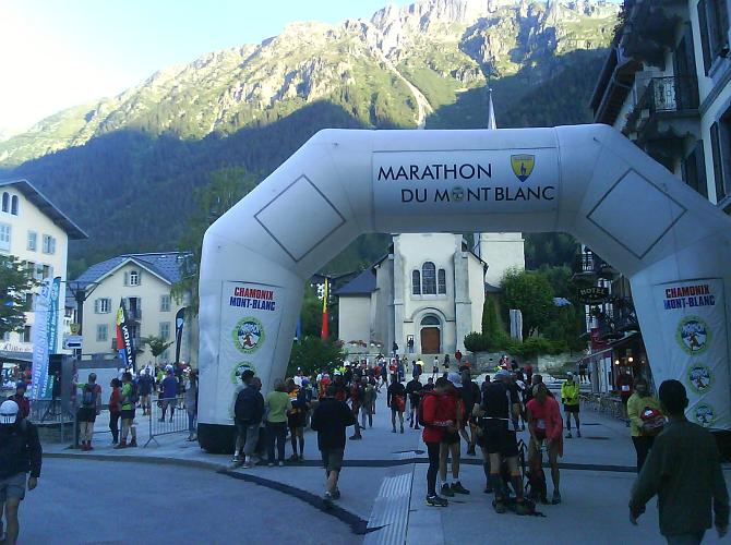
Still, even though I was happy I had the right kit, I
was quite nervous as I walked through the streets of Chamonix
at 6am towards the start line, in front of the tourist
office. As I arrived there were already hundreds of people
there warming up, chatting and looking anxious, in equal
measure. The sky was clear, and it was going to be a hot
day. |
 |
 |
 |
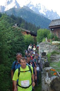
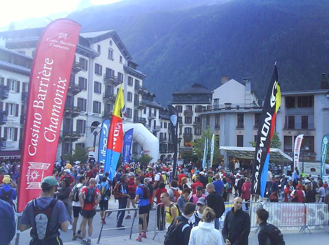
| As
the 7am start time approached, more and more runners arrived,
until there was hardly space to move. The event organisers
gave a briefing, and then the announcer got the crowd
going with Mexican waves and other similar group encouragements.
The atmosphere was great, and my nerves disappeared. On
the balconies overlooking the square, sleepy eyed hotel
residents came out to see what was going on, and to cheer
us on our way. As the clock struck seven, we were counted
down to the start. The runners surged forward, then realised
that 1500 people can't start running without creating
a traffic jam. As we left the square, and turned up the
hill past the Bistro de Sport, we were able to start running
as the street widened to allow people to set their own
pace. |
 |
 |
 |
Along
the road side people rang cow bells, and cheered
as the runners passed them, and for a refreshing
change after all those training runs, as we crossed
road intersections, the police stopped the traffic
as 1500 thundered past. Soon we reached the turn
for the sports centre, and by now I was threading
my way through the pack a bit to set my own pace.
At the micro brewery someone next to me said we
had done the first kilometer. So, only 41 to go!
The route then followed the nordic cross country
ski tracks up the valley towards the village of
Le Bois. Overhead a helicopter hovered very low,
to get film footage of us all.

After
passing Le Bois, the trail starts to make its way
uphill to Lavencher, and at the first sign of a
steep incline some people started speed walking,
then running on the flatter sections. Still there
were a lot of runners very closely grouped, and
so the changes of speed caused a few minor collisions.
As the path to Lavencher got steeper and more rocky,
a few people started tripping over, getting poles
out, and slowing down. I got past the key offenders
and as the track topped out at Lavencher, we were
rewarded with a flatter section. Lavencher
is an Alpine village, as if forgotten by time, and
the route threaded its way through the narrow alleyways
and streets, slowing the pack down to walking pace
in places. |
|
 |
| Soon the alpages were reached, and as the run got onto
the upper section of the Petit Balcon Nord, I was able
to get into a good rhythm and run at my pace. The path
was narrow but good running underfoot, though the odd
tree root has to be jumped over. By now the pace had begun
to settle down a little and there were less changes of
position. Then the path made its descent into Argentiere,
and the path became more rocky. Soon the nordic ski trails
were picked up and then we crossed under the Pierre à
Ric home run ski piste, and made our way through the tracks
to the old centre of Argentiere. As we entered the village,
there were hoards of supporters cheering us on, and best
of all, the first drinks stop. |
 |
 |
 |
| I
grabbed a cup of water and also a cup of coke, then ran
through the old village, with the wooden balconies jutting
out over the road. A sharp turn right, and the route made
its way up hill to the first major incline, the ascent
to the hamlet of Le Planet. The track was narrow and the
pace slowed to a fast walk. I was using my poles by this
stage, and they helped power me up the hill. Fortunately
the hiking guiding had come into play, as the uphill was
easy, but as the path was so narrow there were few overtaking
opportunities. Anyway, soon the plateau was reached, and
as I ran through Le Planet and along the gently ascending
track, I felt good. Then it was down to the left and across
the small wooden bridge and steeply up into the village
of Montroc. |
 |
Another
road crossing, and then up the path to Tre-le-Champ
and upwards to the Col des Montets. The runners
had really started to spread out, and as I crested
the col, I was rewarded with the nice long descent
towards Le Buet. It was quite surreal running past
all the classic meeting points for walks that I
lead clients on each day, but with the great local
knowledge, came a realisation of how far I still
had to go. I had passed the third distance mark,
and had taken under two hours. The only catch was
that I had only climbed 600m out of 2500m. The descent
to Vallorcine was long, and I knew I wasn't descending
very quick, but the hill climbing was still to come.

As I entered Vallorcine I passed a few surprised
looking walkers, who had had their tranquil Alpine
morning walk ruined by hundreds of runners already,
and I knew there were many more on their way. At
the village was the first refreshment stop, and
as well as the drinks, I grabbed a few slices of
saussison, and ate them as I headed over the first
timing line. Then the hill started. Very steeply
at first, then still very steeply. Oh well. I looked
at my altimeter watch and saw my ascent rate as
15m per minute. That was fine, so 900m an hour,
which was bang on my target ascent speed. The hill
was brutal, and when I started to question my sanity,
it slackened off and I regained a good steady pace
again. |
 |
|
|
 |
Everyone
was walking this section, and those with the poles seemed
a lot more comfortable. People were stopping everywhere,
completely drained, and resting on rocks. All the first
section had been run in the shade, but as I got higher,
I emerged above the treeline and into the sun. The track
widened and was hot and dusty. A group of supporters urged
us on, calling out our names from our race number dossards,
and the ringing of the cow bells they had brought, pushed
us more. A group of friends just behind me were chatting
to each other as they climbed. How did they have the breath?
It annoyed me that they could talk. I couldn't contemplate
it, so pushed harder and broke into a run again until
I reached the Col des Posettes.

I
knew that there was a water stop here, but it was tucked
out of sight, and I almost stumbled over it as I turned
towards the Aiguilette des Posettes. Another two cups
of drink, and another for good measure, and I started
on my way upwards. The col had marked the half way point,
and time was going OK. The final 200m of ascent towards
the summit of the Posettes really hurt, as expected. Then
again, in a UK context, this was the same as running a
half marathon distance, then ascending the height of Snowdon
from sea level in an hour straight afterwards. |
 |
 |
 |
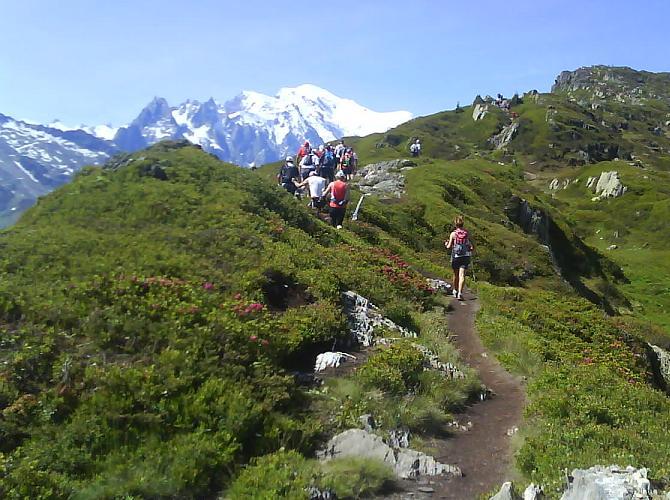
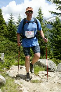
| As
the summit approached, I was rewarded with amazing views
of Mont Blanc ahead, as you can see in the photo above.
Even though the ascent had been hard, this was payback
time, and I felt great. On the top one of the race officials
scanned us through, and then the steep descent began.
Several people fell and twisted ankles, so I took it really
steady, and went at my pace. I let over twenty or so people
past me, but my pace was good and I was letting my legs
get their strength back. Towards the bottom of the mountain,
the route descended into the forests, and the shade was
nice and cool. Then it was a sharp left turn towards the
village of la Tour. |
 |
 |
 |
I
ran into the village, and again several race staff
were there pointing out the way. I dunked my head
in the water trough in the old village and then
made my way past the Chalet Alpin and on the river
track back towards Montroc, that I had run through
about three hours before. I checked with my race
timing sheet, and saw that I still had over 45 minutes
on the maximum
time, as Tre-le-Champ was the first cut off point.
Here there was a good drinks stop, but the first
aid tent was full of people being treated for all
sorts of race injuries. Onwards. I ran up to the
crossing into the Aiguilles Rouges, and spectators
cheered us through. Only 11km to go, but definately
the hardest ones!

The trail narrowed, so overtaking was hard, and
the group was tired. We passed through the forest
and over several streams, for about five kilometers,
then the fun really started. The path zig-zagged
steeply upwards, and again people were dropping
out on every corner to snatch a few gasps of breath.
Eventually I could see the base of the Flegere ski
area cable cars, and knew that there was about 20
minutes to reach the Flegere hut, which was the
next race cut off point, if the maximum time was
exceeded. I had slowed a lot in this last section,
and tried to push on as quick as I could to guard
my margin of time. Fortunately the track widens
at this point to a jeep track, so overtaking was
possible. |
|
 |
| As
I was above the treeline, the sun beat down hard, and
I was tired and hot. The long pull up to the Flegere hut
hurt, but as I reached it I saw that I had increased my
time margin. I grabbed at the drinks and downed as much
as I could, then rounded the corner to get scanned by
the race official. Only six kilometers to go, and I could
see the Planpraz cable car across the valley. At that
stage it seemed a lot further than that, but after the
pain of getting up the hill to Flegere, this section was
relatively flat so it felt like I was floating. |
 |
The
guy I was running with at this stage was fading,
and that spurred me on. After the steep rocky section,
with metal steps in the rock, the track finally
widened, and I ticked off the familiar landmarks
in my head; the avalanche wall, the split rock,
and zig-zag, then the final steep corner, and the
slog up to the finish was just ahead. Three corners
to go. The rubble jeep track was steep and long,
but nothing was going to stop me crossing that line
now. I was still going well, and pushed round the
last corner and towards the line.

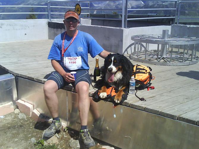
As I approached the line I saw my wife Sarah, and
dog Maximus, cheering me on. Max tried to jump the
barriers to welcome his dad home. I had expected
to feel ready to collapse at the end, but other
priorities were in my line of sight. The race finishers
were all treated to a free beer by the MBC (Chamonix
micro brewery), and once someone had put a medal
around my neck, that's where I was headed! Sarah
had done a sterling job providing a race finishers
pack of sandwiches, drinks, and even a bottle of
champagne. Genius.

After
a quick rest, we got the cable car back down to
Chamonix. Job done. And the result? Well I took
7 hours 59 minutes (compared to the winning time
of 4 hours 5 minutes). I had been aiming for 8 hours,
so not a bad pacing effort. Would
I do it again? Definately. |
 |
|
|
 |
How
did I feel after the race? Amazing, and I went for a decent
hike in Italy the next day, so the legs clearly weren't
too bad. Would I recommend it? Absolutely 100%. If you
love the mountains, relish a big challenge, enjoy the
group atmosphere, and want to undertake the toughest mountain
marathon in Europe, then this is the one for you. I'm
signing up for next year.

See you out in the mountains soon!
Kingsley |
 |
| LINKS---Icicle
Trail Running Main Page---Icicle
Trail Running Courses---Icicle
Trail Running Advice Page |
 |
 |
|
 |
| Popular
links |
 |
 |
| Testimonials |
|
|
|
 |
 |
 |
 |
| Press
& media |
|
|
|
 |
| Films
& videos |
|
|
|
 |
| Photo
gallery |
|
|
|
|
 |
| Our
published articles |
 |
 |
|
 |
|
 |
 |
 |
 |
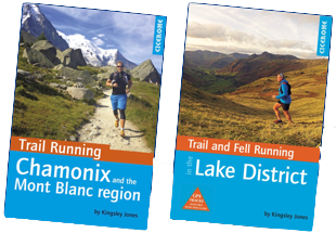 |
Author
signed!
'Trail Running Chamonix &
the Mont Blanc region' link
...or the NEW book...
'Trail
and Fell Running in
the Lake District' buy
a copy
by Kingsley Jones.
Cicerone Press
£14.95 each |
 Each book has 40 trail running Each book has 40 trail running
routes, each with height profiles,
and full colour mapping
 Features
how to adapt your Features
how to adapt your
running in the mountains, and
an index of where to stay
 Includes
famous races in each Includes
famous races in each
region, e.g. UTMB, Langdale
Horseshoe and Chamonix VKM
 To
purchase a copy, click
here To
purchase a copy, click
here |
|
|
|


 |
|
 |
|
|
 |
 |
Icicle logo
is the registered trademark ® of Icicle Mountaineering | | UK company 413 6635. VAT 770
137 933 UK company 413 6635. VAT 770
137 933 |
|
|
|
|


